High Post
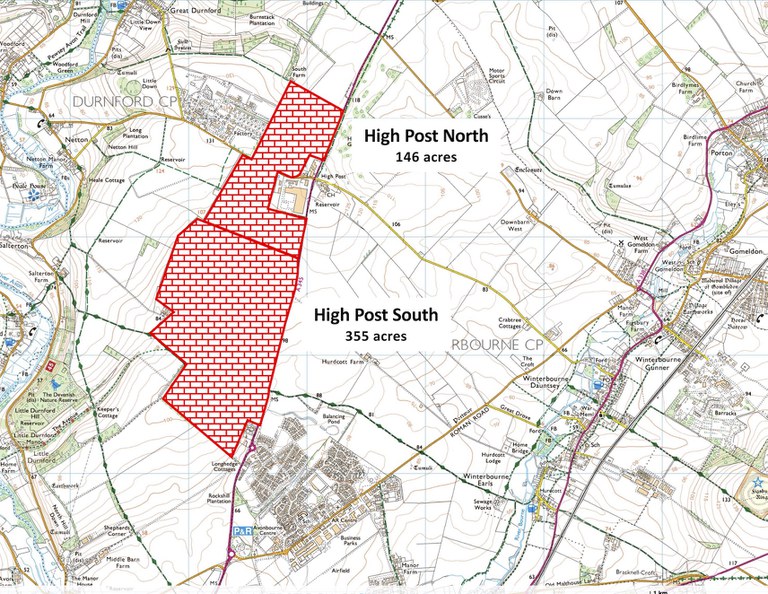
Wiltshire Council is considering proposed developments for industrial, office and residential use at High Post. Together, they total 500 acres of prime farmland.
We can stop this
Why should we care?

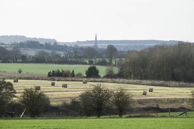
High Post sits almost mid-way between Amesbury and Salisbury on top of Four Mile Hill. Two sites of 146 acres and 355 acres have been proposed for industrial zoning and 500 new houses. The view from the proposed sites includes:
- Clarendon Park
- Salisbury Cathedral
- Old Sarum, the ancient Iron Age hill fort and castle described by English Heritage as “one of the most enthralling and historically important sites in Southern England”
- The Woodford Valley
- Salisbury Plain.
Both sites are categorised as greenfield and are part of working farms.
These sites need protecting, not developing.
The planning case against

- Greenfield sites not included in Wiltshire’s local plan for development
- Risks setting a dangerous precedent for rezoning agricultural land not in the Local Plan
- Plenty of nearby capacity already allocated for similar development
- Surplus to housing and employment need
- No public consultation
- Lack of local amenities
- Increased traffic on routes already at 100% capacity
- Increased light pollution in a rural landscape
- No pavements and cycle lanes from nearby residential areas
- Visible from Old Sarum, a scheduled monument
- Destroying and threatening the habitats of wild animals and plants already disturbed by Longhedge Village and Old Sarum residential developments
- Threatens Monarch’s Way, an historic and popular public right of way on the High Post South site.
